Elevation Certificates

Performing Fresno Elevation Certificates in the San Joaquin Valley
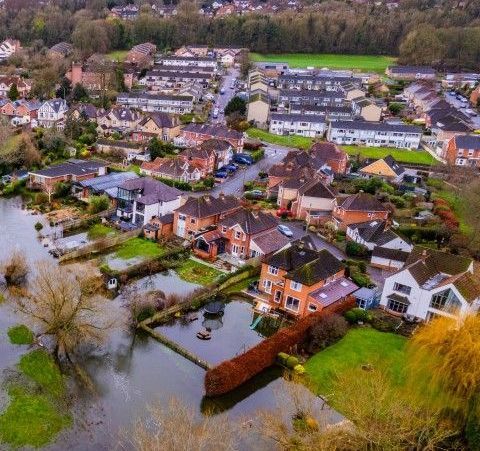
If you're a homeowner, builder, or developer in Fresno, California, understanding elevation certificates is important, especially in areas that might flood. These documents help set flood insurance rates and ensure that buildings follow local rules.
Far & Wide Land Surveying offers services to help you get these flood elevation certificates, making sure your property meets all necessary rules and helps manage flood insurance costs effectively.

Contact Us
What Is an Elevation Certificate?
An elevation certificate is an official document that details a property's location, flood zone, building features, and the height of its lowest floor and lowest adjacent grade (LAG). These documents are commonly part of the closing paperwork when buying or selling a home. Issued by a professional surveyor, they’re also used to check a building’s flood risk and determine flood insurance premiums. In California, these documents may be used to examine local ecosystems, or how water runoff and soil erosion might impact an ecologically fragile area.
Why You Might Need an Elevation Certificate in Fresno
Elevation certificates are important for all types of different reasons. Here are some situations where getting this certificate is necessary:
- Property Transactions: If you're buying or selling property, an elevation certificate can give buyers important information about flood risks. Professionals in the real estate industry and developers may also request these certificates prior to a transaction in order to understand the risk profile of a given property.
- Building Permits: Local authorities might need an elevation certificate to make sure new buildings follow floodplain rules.
- Flood Insurance: Insurance companies use elevation certificates to calculate flood insurance rates. A higher elevation could mean lower insurance costs.
- Disaster Preparedness: Knowing the flood risk of your property can help you take necessary steps to protect your home and family.
Key Functions of an Elevation Certificate as it Pertains to Flooding
Elevation certificates are important for all types of different reasons. Here are some situations where getting this certificate is necessary:
Flood Insurance Determination
Insurance companies use elevation certificates to compare a property's elevation to the base flood elevation (BFE), which helps calculate flood insurance rates. Properties with elevations above the BFE usually have lower insurance costs because of reduced flood risk.
Compliance with NFIP
The National Flood Insurance Program (NFIP) requires communities to follow flood management rules to lessen flood damage. An elevation certificate shows a property meets these rules.
LOMA and LOMR-F Requests
Elevation certificates support applications for Letters of Map Amendment (LOMA) or Letters of Map Revision based on Fill (LOMR-F). If you suspect the land (especially flood zones) in your neighborhood has changed over the years, you can have us check the elevations around your property. If it is determined that you are no longer in a high-risk flood zone or the original cert was incorrect, you could apply for a reassessment by FEMA using a LOMA or LoMR-F to see if they will grant your request. These letters can result in edits to change flood maps and possibly remove properties from high-risk flood zones, taking away the need for required flood insurance which can save you money.
How to Obtain an Elevation Certificate in California
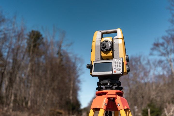
Getting an elevation certificate in the Central Valley involves hiring a licensed land surveyor. At Far & Wide Land Surveying, we specialize in providing accurate and reliable FEMA elevation certificates for properties in Fresno, Merced County, or Kings County. Our team of experts understands Fresno's unique landscape and flood risks, ensuring your flood elevation certificate is accurate and follows all local rules.
Steps to Get an Elevation Certificate:
Hire a Professional:
- Contact Far & Wide Land Surveying: If no existing certificate is available or the one you find is more than five or ten years old, reach out to us to discuss your needs and schedule a survey. Our licensed land surveyors are authorized to certify elevations, including the lowest adjacent grade (LAG).
- Site Survey: Our team will visit your property to conduct a thorough site survey, gathering all necessary data such as measurements in relation to stationary monuments, elevations at various points around the land, established structures, and drainage patterns in order to complete the elevation certificate.
- Certificate Issuance: After the survey, we'll provide you with a detailed elevation certificate that you can use for insurance, permits, home sales, or other purposes.
Check For Existing Records:
- You can start by contacting the city to see if an EC is already on file from history. Many communities keep records of these certificates for properties within SFHAs.
- Review your property documents. You may have a copy with the title or one that was provided during the original transaction of your home. If you know how the builder or developer was, you can try contacting them too to see if they obtained one during construction.

Why Choose a Licensed Surveyor like Far & Wide Land Surveying
Far & Wide Land Surveying is a trusted provider of elevation certificates in Fresno and the surrounding areas. We also handle complex tasks such as ALTA surveys and topographic surveys for both residential and commercial customers. With lots of experience in land surveying and accessibility rules, we offer reliable and accurate survey packages to property owners, developers, and insurance professionals.
Expertise
With years of experience, we are well-equipped to handle the complexities of obtaining a FEMA elevation certificate on large and small properties, ensuring precise measurements and compliance with FEMA guidelines.
Customer Satisfaction
We are committed to providing exceptional customer service, making obtaining an elevation cert smooth and hassle-free.
Local Knowledge
Our familiarity with the Fresno area and its specific floodplain regulations allows us to offer tailored solutions to meet the unique needs of local property owners.
Get Your Fresno County Elevation Certificate Today
If you need a Fresno County elevation certificate or have questions about how it can benefit your property, contact Far & Wide Land Surveying today. Our experts are ready to assist you with all your surveying needs, providing you with peace of mind and the necessary documentation to protect your investment.